The Irish transportation sector is undergoing a significant transformation, with a clear focus on sustainability and efficiency.
To achieve these goals, innovative technologies are crucial, and Earth Observation (EO) and Geographic Information Systems (GIS) are emerging as powerful tools for navigating this exciting new landscape.
The Irish Transport Landscape – Challenges and Opportunities
Ireland’s transport sector faces several challenges. Traffic congestion, particularly in urban areas, not only frustrates commuters but also contributes to air pollution.
Furthermore, optimising public transport routes and infrastructure development for a growing population requires careful planning and resource allocation.
However, these challenges also present exciting opportunities, such as the Irish government’s commitment to a greener future, outlined in the Climate Action Plan 2021, prioritises reducing transport emissions by 51% by 2030.
This ambitious goal necessitates innovative solutions, and EO and GIS technologies are perfectly positioned to play a leading role.
Unveiling the Powerhouse for Sustainable Transport
EO provides invaluable data about our planet, captured from satellites and aerial platforms, offering insights into land use, traffic patterns, and environmental conditions.
GIS acts as the command centre for this data, allowing us to visualise, analyse, and interpret it.
This powerful combination unlocks a treasure trove of information for the transport sector.
Optimising Public Transport Networks
Analysing ridership data alongside population density through GIS allows for the creation of efficient public transport routes that best serve passenger needs.
This not only reduces congestion and travel time but also encourages people to shift from private vehicles to public transport, ultimately lowering emissions.
Combating Traffic Congestion
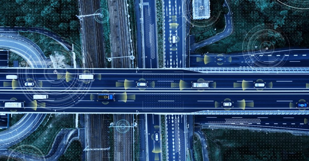
Real-time traffic data, monitored by EO and visualised through GIS, enables dynamic traffic management strategies.
Imagine intelligent traffic lights that adjust based on real-time traffic flow, or congestion alerts rerouting drivers to avoid gridlocked areas.
This not only reduces travel time and frustration but also minimises emissions caused by idling vehicles.
Planning Green Infrastructure
EO data unveils a wealth of information about land use patterns and environmental considerations.
By integrating this data into GIS, transportation planners can design sustainable infrastructure projects that minimise environmental impact.
Imagine strategically locating electric vehicle charging stations based on traffic patterns or utilising EO data to identify optimal locations for new cycling paths that minimise disruption to ecosystems.
The Road to Sustainability
At Compass Informatics, we have extensive experience collaborating with transport organisations in Ireland and beyond.
We leverage the power of EO and GIS by helping our clients to:
- Streamline logistics and optimise delivery routes: Imagine delivery companies minimising travel distances and fuel consumption by utilising optimised routes based on real-time traffic data and location intelligence.
- Enhance safety and efficiency in public transportation networks: By analysing ridership data and identifying areas with high traffic volume, we can help public transport authorities optimise network efficiency and improve the overall travel experience.
- Develop data-driven strategies for reducing transportation emissions: Our expertise in EO and GIS empowers us to analyse traffic patterns and identify areas with high emissions. Armed with this data, transport organisations can implement targeted strategies to reduce their environmental footprint.
Shaping the Future of Irish Transportation Together
We believe that EO and GIS technologies hold tremendous potential for revolutionising Irish transportation.
By working collaboratively with government agencies, transport operators, and technology providers, we can create a more sustainable and efficient transport network for Ireland.
Compass Informatics is committed to playing a leading role in this exciting journey.
We invite you to connect with us at the upcoming Transport Research Arena (TRA) Conference in Dublin this April, where we will be showcasing our expertise and fostering collaboration to shape the future of Irish transportation.
Together, let’s leverage the power of EO and GIS to build a greener, more sustainable transport future for Ireland!


