
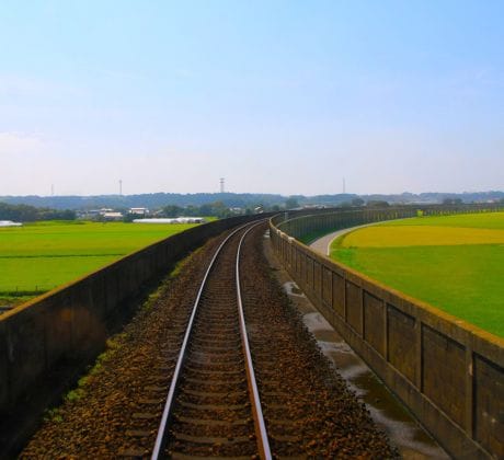
As Ireland accelerates efforts to modernise and expand its public transport systems, particularly rail, the need for smarter, data-driven infrastructure planning has never been greater.
From the Western Rail Corridor to key intercity connections and potential high-speed routes, railway development must balance efficiency, environmental impact, land usage, and community needs. This is exactly where Linear Infrastructure Modelling plays a key role – one of Compass Informatics’ core strengths that supports smarter and more sustainable transport planning.

What Is Linear Infrastructure Modelling?
Linear Infrastructure Modelling uses spatial data and intelligent algorithms to identify optimal route corridors for long, linear assets like railways, roads, and pipelines.
The technique blends a wide range of geographic, topographic, and socioeconomic datasets such as:
- Elevation & slope
- Existing infrastructure
- Land use & zoning
- Environmental designations
- Urban density
- Asset risk and resilience
It helps planners, engineers, and decision-makers see practical, budget-friendly, and eco-friendly rail routes before any work even starts on the ground.
Identifying Optimal Railway Corridors in Ireland
In a country where population growth, urban expansion, and regional connectivity are driving demand for more sustainable transport, identifying the most viable routes for new or expanded railway lines is a complex task. Traditional approaches often rely heavily on manual assessment, limited datasets, or legacy planning assumptions.
Compass Informatics applies Linear Infrastructure Modelling to bring data-driven precision to this challenge. Our modelling framework supports:
- Early-stage feasibility studies by mapping corridor options that consider physical, environmental, and policy constraints
- Strategic alignment with national and regional transport objectives, including those from the National Development Plan and Transport Strategy for the Greater Dublin Area
- Minimised environmental and community disruption, using sensitivity layers such as SACs, SPAs, flood zones, and population density
- Improved capital efficiency by flagging cost-intensive terrain (e.g. steep gradients or ecologically sensitive areas) before planning reaches the design phase
By using high-resolution geospatial datasets and decision-support models, we help government agencies and transport authorities make better-informed decisions—reducing uncertainty, improving transparency, and saving both time and resources during the planning process.
A Proven Approach, From the Belt and Road to Irish Railways
Our international work with WWF on the Belt and Road Initiative required us to model 2,000+ potential linear infrastructure routes across 71 countries. We built a geospatial decision-support system capable of route prediction based on real-world terrain and constraints.
See Full Case Study – Linear Infrastructure Modelling – WWF
Planning Ireland’s rail infrastructure is all about using smart, data-driven insights.
As part of national transport strategy and regional development, new rail projects in Ireland must navigate a host of planning, cost, and community challenges. That’s where our Linear Infrastructure Modelling methodology adds value:
Multi-criteria analysis to align transport policy with real-world geography Optimised corridor selection to reduce land acquisition and construction costs Scenario modelling to assess routes under different economic or environmental assumptions GIS-based visualisation for clear communication with stakeholders and the public
Our Method: From Data to Decisions
Our four-phase approach provides end-to-end insight:
- Data Collection & Evaluation – Gathering geospatial datasets from TII, Irish Rail, NPWS, CSO and others
- Criteria Weighting & Reclassification – Applying project-specific “business rules”
- Raster-Based GIS Modelling – Standardising data and layering impact zones
- Route Analysis & Evaluation – Producing visual and analytical route comparisons

The Outcome? Better Informed, More Sustainable Transport Networks
Linear Infrastructure Modelling supports a more strategic, transparent and sustainable way of delivering railway infrastructure—whether it’s new lines, extensions, or upgrades.
By leveraging GIS, AI, and Earth Observation technologies, Compass Informatics empowers public agencies, planners and consultants to make better transport decisions faster.
Compass Informatics is an Irish technology company specialising in Location Technologies, GIS, and Data Analytics. Part of the Tracsis Group, Compass supports public and private sector organisations across Ireland, the UK, and globally.
Interested in how Linear Infrastructure Modelling can support your transport or infrastructure planning project?