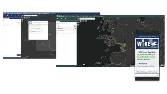
The Weather Impacts Register (WIRE) is a location based mobile App developed on behalf of CARO, the local government office for the coordination of local government activities related to climate impact in Ireland.
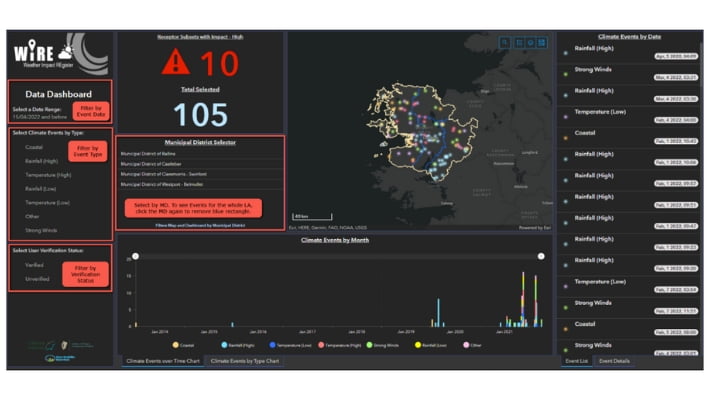
The app allows Local Authority staff to record and collect data on the impacts of weather events, and features an online Map Viewer and Data Dashboard to view and analyse spatial event information.
The system was created using ESRI’s ArcGIS Online and Survey123 suite of applications, and involved the management of complex data flows, custom user views and authorisation, and location data presentation and reporting.
The data collected will be used to inform climate risk and vulnerability assessments for Local Authorities and to develop an evidence-based approach to climate adaptation planning at a local and regional level.