
Protecting animal habitats has never been more complex or more urgent. Climate change, land-use pressure, and infrastructure expansion are reshaping ecosystems faster than traditional conservation methods can respond.
To safeguard biodiversity effectively, environmental organisations need more than field observations, they need continuous, large-scale, data-driven insight. Our Geospatial analytics and integrated land management systems combine environmental datasets, spatial modelling, and monitoring technologies to support organisations and provide insights as to how habitats function, how they change over time, and where intervention is most effective.
The urgency of this shift is clear. Ireland’s most recent national biodiversity assessment shows that 90% of protected habitats are in unfavourable conservation status, with over half continuing to deteriorate.
Why Monitoring Habitat Connectivity Is Central to Conservation
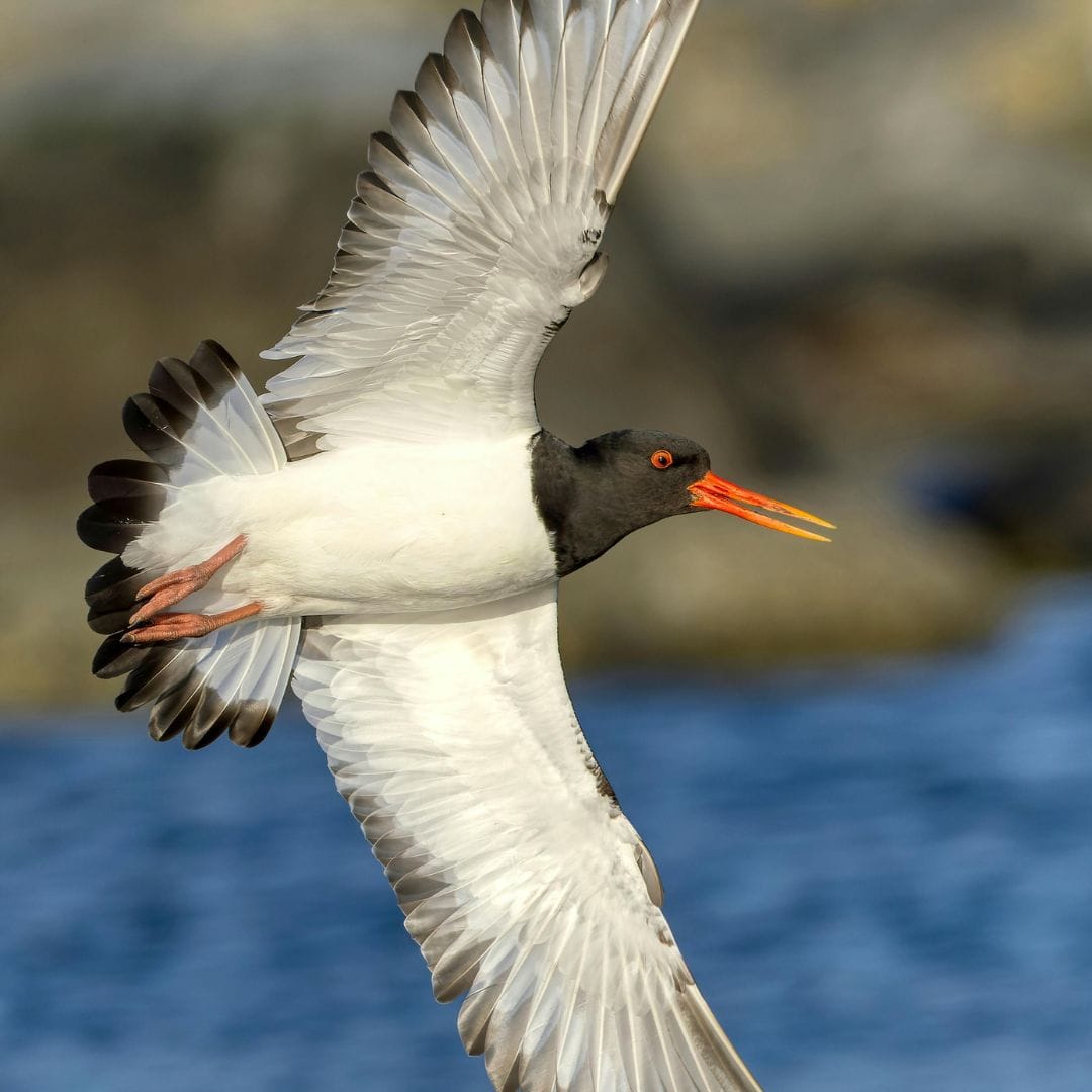
Migratory species depend on connected ecosystems. Rivers must flow freely, wetlands must remain intact, and land corridors must remain accessible. Even small disruptions — such as barriers, land-use change, or temperature shifts, can have cascading ecological consequences.
Traditional conservation approaches often focus on protecting individual sites. However, modern ecological science recognises that connectivity is just as important as protection. Species survival depends on movement for breeding, feeding, seasonal migration, and genetic diversity.
Geospatial monitoring enables conservationists to:
- Map ecological corridors across landscapes and river networks
- Identify fragmentation and physical barriers
- Track habitat condition over time
- Model species movement patterns
- Prioritise restoration where impact will be greatest
This creates a strategic, evidence-based framework for protecting biodiversity at scale.
Turning Environmental Data Into Conservation Action
Environmental data exists in many forms — satellite imagery, hydrological measurements, land-use records, biodiversity surveys, and climate projections. The challenge is integrating these fragmented datasets into a single, actionable picture.
Spatial analytics platforms bring these data layers together to create dynamic environmental models. Instead of isolated observations, decision-makers gain a system-level understanding of ecosystem behaviour.
This level of insight is increasingly important. While habitat condition remains a major concern, species trends show that targeted intervention can work — with over two-thirds of protected species in Ireland now stable or improving, demonstrating the impact of evidence-based conservation strategies.
The challenge is scaling those successes across entire ecosystems — which requires better monitoring and spatial intelligence.

Safeguarding Migratory Species Through River Connectivity Analysis
River ecosystems provide a powerful example of how geospatial analysis supports conservation. Migratory fish species — such as salmon and eel — rely on uninterrupted river systems to complete their life cycles. Yet many waterways are fragmented by dams, weirs, and other barriers.
Large-scale spatial analysis allows environmental scientists to:
- Map barrier locations across entire river networks
- Assess ecological impact at system level
- Model restoration scenarios
- Prioritise barrier removal or modification
- Predict biodiversity recovery outcomes
This type of work has been demonstrated through initiatives such as EU AMBER project, which analysed river fragmentation across Europe to support ecological restoration and biodiversity recovery.
This approach transforms restoration from local intervention into strategic ecosystem recovery.
The Role of Land Management Systems in Long-Term Habitat Monitoring
Conservation is not a one-time action, it requires continuous monitoring and adaptive management. Land management systems provide the digital infrastructure to support this ongoing process.
These platforms centralise environmental information, allowing organisations to track:
- Land-use change
- Habitat condition indicators
- Environmental compliance
- Restoration progress
- Ecosystem health trends
Integrated systems also enable collaboration between agencies, researchers, planners, and policymakers.
Programmes such as ECHOES demonstrate how structured land management platforms support coordinated environmental stewardship and long-term spatial monitoring.
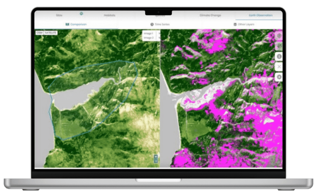
Understanding NDVI and Its Role in Species Conservation
The Normalised Difference Vegetation Index (NDVI) uses satellite imagery to measure vegetation health and density. Healthy plants reflect light differently than stressed or sparse vegetation, allowing NDVI to provide a clear, objective score of habitat condition.
NDVI is crucial for conservation because vegetation directly supports animal habitats. It helps managers:
- Detect habitat degradation early
- Monitor restoration success
- Track seasonal and long-term changes
- Prioritize conservation actions
In platforms like ECHOES, NDVI Change Detection turns vegetation data into actionable insight, enabling proactive protection of habitats for migratory species and other wildlife.
Supporting Sustainability Goals through Conservation
While species protection is the primary objective, geospatial monitoring delivers broader sustainability benefits. Healthy ecosystems provide essential services, flood regulation, carbon storage, water purification, and climate resilience. When habitats degrade, these services weaken, increasing environmental and economic risk.
Spatial environmental monitoring supports sustainability by enabling:
-
Evidence-based land-use planning
-
Climate adaptation modelling
-
Environmental impact assessment
-
Resource management optimisation
-
Long-term ecosystem health tracking

Smarter Infrastructure Planning
With geospatial monitoring, planners can spot sensitive habitats, migration corridors, flood-prone areas, and other ecological risks before construction even starts. That means projects can be designed smarter from the get-go, reducing harm to nature, avoiding expensive fixes later, and keeping everything compliant with environmental regulations.
With Compass’s Linear Infrastructure solution, planners can quickly spot sensitive habitats, migration corridors, and ecological risks before construction starts. This makes projects smarter, safer for wildlife, and less likely to need costly fixes later.
A New Model for Environmental Stewardship
Geospatial analytics and land management systems are redefining how we understand and protect the natural world. By integrating environmental data, modelling ecosystem dynamics, and supporting evidence-based decision-making, these technologies enable a new model of conservation:
Connected. Continuous. Predictive. Strategic.
Their impact extends beyond species protection, strengthening sustainability policy, improving land governance, and enabling responsible infrastructure planning. As environmental pressures intensify, the ability to monitor, understand, and manage habitats at scale will become one of the most important tools in safeguarding biodiversity for future generations.