

Managing Land Risk on Ireland’s Rail Infrastructure Programmes
Ireland is in the midst of a sustained period of investment in its transport network, with rail at the centre of national plans to expand capacity, improve connectivity, and support more sustainable travel.
New lines, electrification, station upgrades, and network renewal are all being progressed in parallel, and each brings the same underlying challenge – delivering complex, multi-year infrastructure works across land that is rarely straightforward to acquire, manage, or protect from environmental and climate risk.
This scale of ambition puts real pressure on the Tier 1 contractors and engineering teams tasked with delivery. They’re being asked to move faster, coordinate across larger and more complex programmes, and meet tighter environmental and climate-resilience requirements than ever before.
Where Land Data Actually Costs You Time
Land and asset data problems rarely show up where you’d expect. They surface mid-programme, when a boundary discrepancy halts a possession, when a wayleave hasn’t been finalised before a construction window opens, or when an updated flood risk map forces a redesign that wasn’t budgeted for. A few of the most common friction points we see on linear infrastructure programmes:
- Fragmented land ownership and tenure data. Rail corridors cross dozens or hundreds of individual land parcels, often held across multiple registries and formats. Without a single, current view, acquisition and wayleave status becomes difficult to track against the construction programme.
- Constraint data that goes stale. Environmental designations, protected habitats, archaeology, and flood risk zones can shift during a multi-year programme. Contractors need to know when a constraint has changed, not discover it on site.
- Disconnected data between design, planning, and delivery teams. When land and constraint data lives in static PDFs or siloed spreadsheets, every handover between design, procurement, and construction introduces risk of using an outdated version.
- Compliance evidence. Increasingly, planning conditions and climate-resilience commitments require contractors to demonstrate how land and environmental risk was managed throughout delivery, not just at design stage.
None of these are new problems in principle. What’s changed is the scale and pace at which Ireland’s rail programmes now need to move, which means manual, spreadsheet-based land tracking is no longer a viable way to manage that risk.
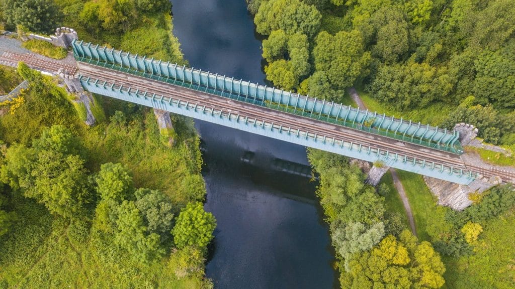
Turning Land and Constraint Data Into a Live Delivery Tool
This is where geospatial intelligence earns its place on the project team, not as a planning nicety but as an operational tool. At Compass Informatics, our work with organisations such as the National Transport Authority has centred on exactly this: building GIS data services, land cover production, and system integrations that give agencies and delivery teams a single, trusted source of truth rather than a static map produced once and left to age.
Our Linear Infrastructure Modelling methodology, developed and applied across major route-planning programmes, blends terrain, environmental, and land ownership datasets to identify and track constraints along a corridor from early planning right through to delivery. Combined with land management systems such as our Area Monitoring System, that update as acquisition and wayleave status changes, this gives engineering and delivery teams a live picture of land risk against the construction programme, rather than a snapshot that’s out of date by the time the enabling works start.
For civil engineers and project managers, the practical benefit is straightforward: fewer surprises on site, clearer visibility of which parcels are ready for possession, and a defensible audit trail when compliance and climate-resilience reporting is required.
What Our Land Management Systems Actually Do
Our Land Management Systems, such as our Area Monitoring System are built to take land and environmental data out of static documents and spreadsheets and into a live, shared platform. In practice, this means:
- Mapping land use and land cover across a corridor or project area, giving engineering and planning teams an accurate, current baseline rather than a dataset that’s out of date by the time it reaches the field.
- Detecting change over time, so shifts in vegetation, ground condition, or land use, whether natural or the result of construction activity, can be identified and tracked rather than discovered on site.
- Applying machine learning to EO imagery to extract meaningful insight from large volumes of satellite and sensor data, at a scale and consistency that manual review can’t match.
- Supporting evidence-based decisions on land and environmental risk, giving delivery teams a clearer, data-backed basis for managing constraints and reporting on environmental and climate-resilience commitments.
- A secure, cloud-hosted map portal that gives project teams, contractors, and stakeholders remote access to up-to-date land and environmental data from wherever they’re working.
- Data integration from multiple sources, bringing land ownership, environmental designations, and Earth Observation data (including satellite and VHR imagery) together in one place rather than scattered across separate systems.
- Workflow tools for data quality assurance, allowing teams to review, validate, and update records as land status or environmental conditions change, so decisions are always made on current data.
- Collaboration features that let engineering, planning, and environmental teams work from the same evidence base, reducing the risk of handover errors between design and delivery.
- Reporting and output tools that turn underlying data into clear, exportable outputs for stakeholder communication and regulatory or compliance reporting.
Applied to rail infrastructure, this kind of land use and condition mapping gives engineering and delivery teams an accurate, evolving picture of the land a programme depends on, supporting better decisions on environmental risk and climate resilience throughout delivery, not just at the planning stage.
These are the same core capabilities we’ve applied to land and habitat management challenges elsewhere, adapted here to the specific demands of linear infrastructure delivery: tracking land status across a corridor, keeping constraint data current, and giving delivery teams a defensible record of how land and environmental risk was managed throughout a programme.

Award winning solutions backed by industry-leading technology
Our Area Monitoring System draws on satellite Earth Observation data to deliver automated, repeatable assessment of land use and land cover change at scale. Developed in partnership with the European Space Agency’s InCubed programme, the system — known as HubCAP — provides a platform and service that enables automated land use assessment across multiple sectors, including agricultural subsidy compliance, environmental land monitoring, and private-sector land asset validation. Built on Copernicus data and Compass Informatics’ own Earth Observation toolkit, the platform is designed to be accessible to non-technical business users while offering a comprehensive API for direct integration with existing administration systems. This partnership with ESA underpins our ability to deliver scalable, transparent, and fully auditable land monitoring services to public and private sector clients across Europe.
Our Land Management Viewer
We design and deliver Land Management Viewers, centralised, web‑based mapping platforms that give organisations a single, authoritative view of their land ownership and property portfolios.
For clients managing land across multiple subsidiaries or business units, we consolidate fragmented mapping systems into one unified platform. This includes establishing a dedicated GIS environment, migrating legacy CAD and mapping data into modern, standardised GIS formats, and enriching it with the supporting layers needed for day-to-day decision-making. The result is a viewer built for practical use in the field and office alike, with drawing, measurement, overlay, and printing tools that support site assessment, boundary review, and reporting.
Where organisations are running on outdated or unsupported mapping technology, we manage the full transition to a modern, secure, and actively maintained platform, minimising disruption while future-proofing the system against obsolescence.
Every implementation begins with a thorough business analysis phase, in which we work closely with your teams to identify and integrate all relevant land folios, supporting documentation, and spatial datasets. This ensures the viewer becomes a genuine “single source of truth” removing inconsistencies between departments and giving every business unit access to the same accurate, consolidated geospatial information.
The outcome is a cohesive land-management ecosystem that lets organisations and their subsidiaries access reliable spatial data, collaborate across teams, and make well-informed decisions across nationwide property portfolios, all from one authoritative, easy-to-access hub.
Our Partnership Gives You Access to a Network of Expertise and Solutions
Under the Tracsis umbrella, clients can access a broad and complementary portfolio of solutions spanning operations analytics, asset management, digital rail technology, geospatial intelligence and data analytics.
From strategic route planning to day-to-day asset and land management, geospatial intelligence can support better decisions throughout the railway lifecycle.
For Tier 1 contractors delivering rail infrastructure programmes, this means a single partner can support land and constraint data from the earliest planning stages through to construction handover and asset management once the line is operational, backed by rail sector expertise that goes beyond geospatial data alone.
Delivering Rail Infrastructure Doesn’t Have to Mean Managing Land Risk in Spreadsheets
As Ireland’s rail investment programme moves from planning into large-scale delivery, the contractors who win and retain this work will be the ones who can demonstrate control over land and environmental risk throughout the programme, not just at the planning application stage.
If your team is preparing to deliver on rail infrastructure programmes across Ireland, we’d welcome a conversation about how our geospatial and land management expertise, backed by the wider Tracsis network, can support your delivery teams from constraint to construction.
Get in touch with or team to discuss how we can support your next rail infrastructure programme.