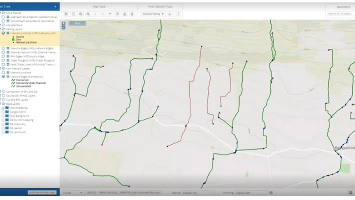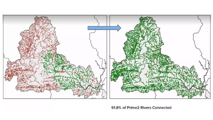
Leveraging over two decades of experience working with the original river networks, Compass played a groundbreaking role in developing the Environmental Protection Agency (EPA) Ireland’s Waterline river network layer in the early/mid 2000s.
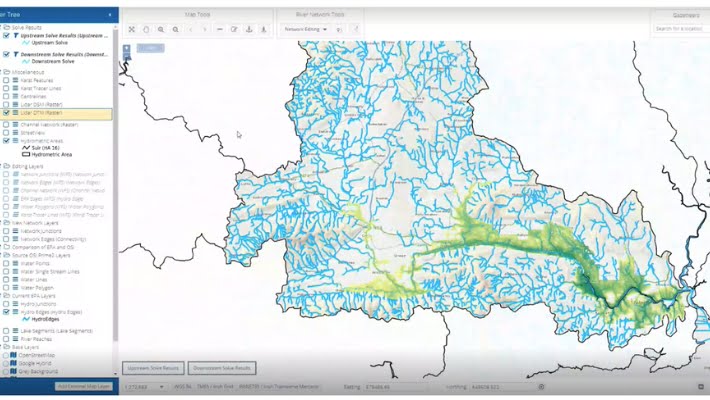
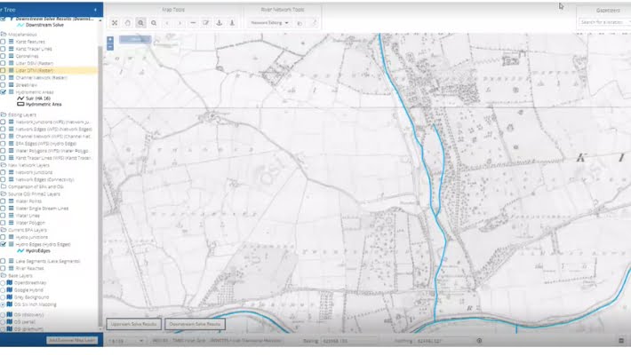
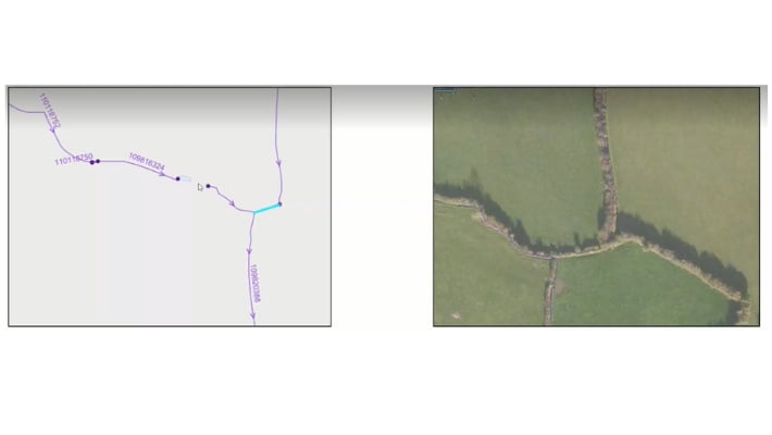
We’re now building on this expertise by collaborating with the EPA to convert the recently released Prime2 geospatial data from Tailte Éireann into a new, even more comprehensive river network.
This next-generation network will supersede the original one and provide a foundation for even more advanced river analysis.